


| Application: | Trajectory Data Process | Brand: | Geosun |
|---|---|---|---|
| Function: | Velocity | Precision: | Less Than 5 Cm |
| High Light: |
GNSS INS Trajectory Processing SoftwareGeosun Shuttle SoftwareGeosun Trajectory Processing Software |
||
Shuttle Software with Independent Property Right
Shuttle Software with Trajectory Process , GNSS/INS Software
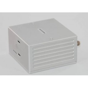
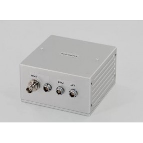
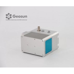
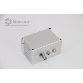
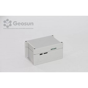
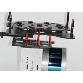
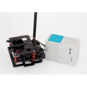
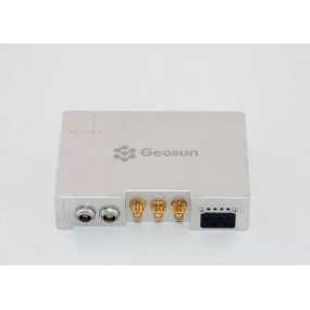
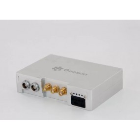
Shuttle is a high-precision GNSS/INS positioning and attitude determination post-processing software, independently developed by Wuhan Geosun Navigation Technology Co., Ltd., built-in high precision GPS/GLONASS/Beidou II/Galileo positioning velocity measurement processor (GGPoS). The system can process multi-mode GNSS positioning velocity measurement, GNSS/INS combined positioning attitude measurement, providing centimeter-level spatial position information of motion point (or carrier), centimeter-level speed information, and thousand-degree attitude information.
Shuttle adopts the world's leading single epoch ambiguity algorithm and high-order Kalman filter to maximize integrate the GNSS carrier phase and inertial navigation component (IMU) information. Compared to GNSS post-processing, GNSS/INS combination provides richer carrier dynamic information, higher resolution accuracy and reliability. Shuttle is compatible with both incremental and rate type IMU data, providing a rich IMU random error model, having processing capability with various accuracy levels of IMU data. It surpasses international similar software in many aspects and provides better choices for users, especially Chinese users.
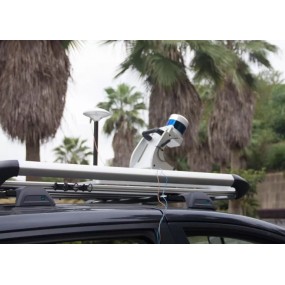
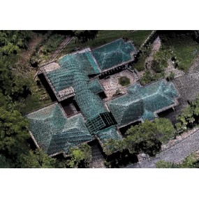
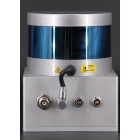
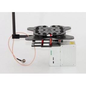
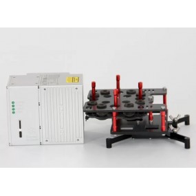
Shuttle is widely used in aerial photogrammetry, urban mobile measurement and other high-precision positioning attitudes, such as railways, urban transportation, and aerospace vehicles. In addition, Shuttle is based on a component-based model with good scalability and even a flexible product range.
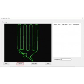
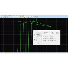
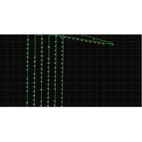
Trajectory Process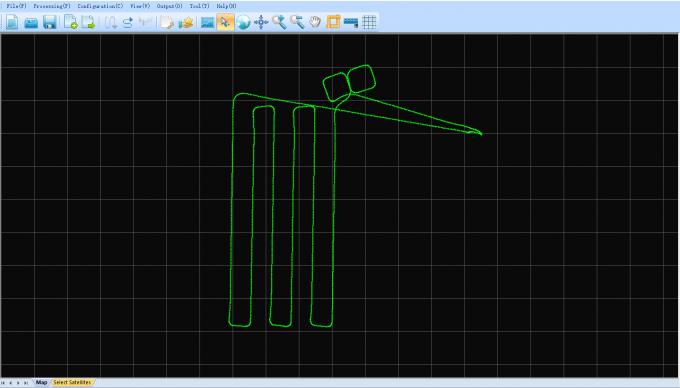
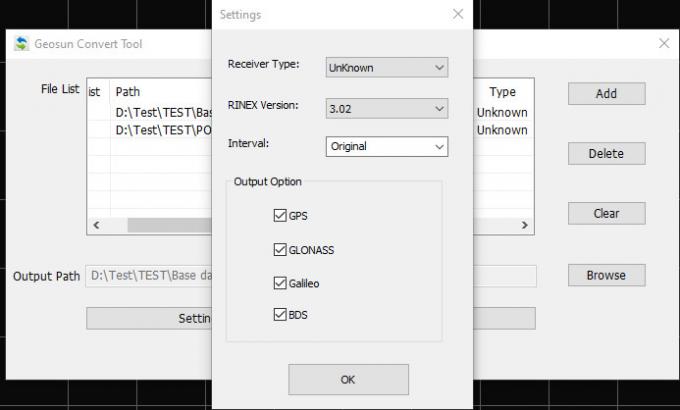
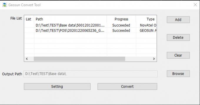
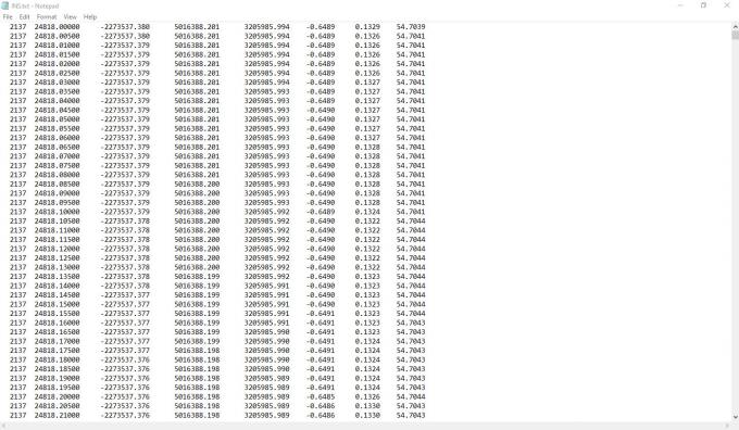
Select the Satellites and GNSS Date Decode (the .kqs file to .20o file)
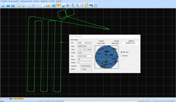
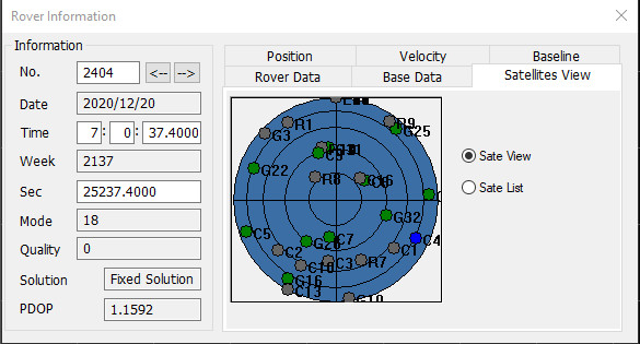
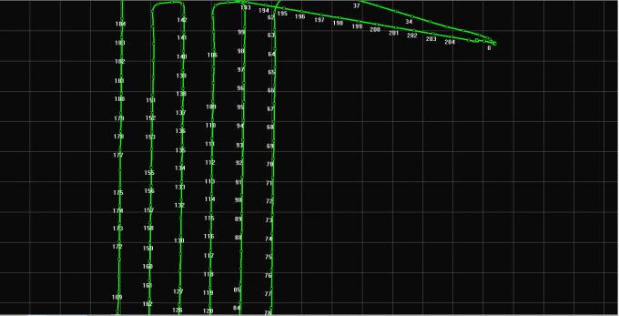
The GNSS results from Shuttle (kinematic Differencial GNSS)
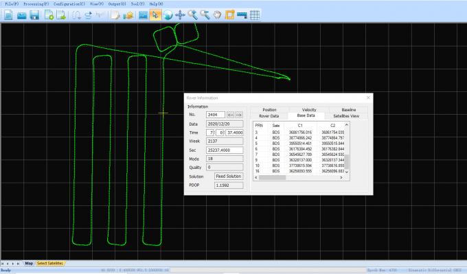

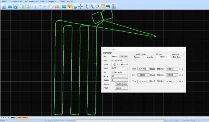
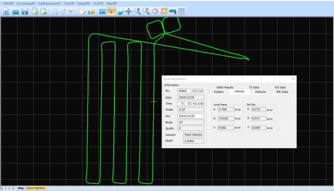
The GNSS/INS Integration results from Shuttle
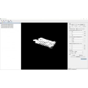
Satellites View
Camera Trigger Event
INS Result
The links of 6.1 version of Shuttle software as following
https://drive.google.com/drive/folders/1S796Gns3sT96dUYv9XrzTcPTSULjAsF1?usp=sharing
16 other products in the same category:
gAirHawk Software Introduction Point Cloud Data Process and LAS File Generated SoftwaregAirHawk is a lidar scanning system acquisition monitoring and point cloud computing software self-developed...
GNSS/INS System Integrated Laser Sensors AGS 301 (302/303) adds a high-precision inertial navigation (IMU) module, no matter how the fuselage tilts during the aviation flight, it can accurately...
gAirHawk GS-260X UAV LIDAR SCANNING SYSTEM LiDAR Scanning System Application for 3D Surveying and Mapping gAirHawk GS-260X is a kind of Mid-range, compact LiDAR point cloud data acquisition system,...
GNSS/INS System Integrated Laser Sensors AGS 302 (301/303) adds a high-precision inertial navigation (IMU) module, no matter how the fuselage tilts during the aviation flight, it can accurately...

Positioning and Altitude Determination System AGS 302 (301/303) adds a high-precision inertial navigation (IMU) module, no matter how the fuselage tilts during the aviation flight, it can...

gAirHawk GS-260F UAV LIDAR SCANNING SYSTEM Drone LiDAR Scanning System Application for Mapping and Survey gAirHawk GS-260F is a kind of Mid-range, compact LiDAR point cloud data acquisition system,...

gAirHawk Introduction 3D LiDAR Data Processing Software With Color PT File OutputgAirHawk is a lidar scanning system acquisition monitoring and point cloud computing software self-developed by...
gAirHawk GS-1350 UAV LIDAR SCANNING SYSTEM UAV LiDAR Scanning System with Long Range Riegl Sensor gAirHawk GS-1350 is a kind of long range, compact LiDAR point cloud data acquisition system,...
gAirHawk GS-100V LIDAR SCANNING SYSTEM Mobile LiDAR Scanning System with Velodyne Scanner gAirHawk GS-100V is a kind of short range, compact LiDAR point cloud data acquisition system, integrated...
gAirHawk GS-100C+ LIDAR SCANNING SYSTEM Mobile LiDAR Scanning System Mounted on Vehicle Integrated DJI L1 Laser Sensor and Build-in CameragAirHawk GS-100C+ is a kind of light compact LiDAR point...
gAirHawk GS-260P LIDAR SCANNING SYSTEM Drone LiDAR Scanning System mounted on DJI M300 with 3D data collectiongAirHawk GS-260P is a kind of light compact LiDAR point cloud data acquisition system,...
gAirHawk GS-100V UAV LIDAR SCANNING SYSTEM Uav LiDAR Scanning System with 3D Spatial Data Collecting Velodnye Laser Sensor gAirHawk GS-100V is a kind of short range, compact LiDAR point cloud data...

gAirHawk GS-130H UAV LIDAR SCANNING SYSTEM UAV LiDAR Scanning System with Livox Horizon Laser Sensor gAirHawk GS-130H New Designed is a kind of short range, compact LiDAR point cloud data...
GNSS/INS System with 3D Data Collector AGS 300 adds a high-precision inertial navigation (IMU) module, no matter how the fuselage tilts during the aviation flight, it can accurately provide...
gAirHawk GS-100M+ LIDAR SCANNING SYSTEM UAV LiDAR Scanning System with Triple Echo Livox Avia Laser SensorgAirHawk GS-100M+ is a kind of light compact LiDAR point cloud data acquisition system,...
| Application: | Trajectory Data Process | Brand: | Geosun |
|---|---|---|---|
| Function: | Velocity | Precision: | Less Than 5 Cm |
| High Light: |
GNSS INS Trajectory Processing SoftwareGeosun Shuttle SoftwareGeosun Trajectory Processing Software |
||
error Your review appreciation cannot be sent