


| Operation Efficiency: | 1.92 Km2 / Single Flight | Applicaton: | Mapping & Survey |
|---|---|---|---|
| High Dencity: | 240000 Points/s | Light Weight: | Less Than 750 G |
| Compatibility: | Multi Rotor/ VTOL | Application: | Forestry |
| High Light: |
1.92km2 UAV LiDAR System20W UAV LiDAR System20W Triple Echo UAV LiDAR System |
||
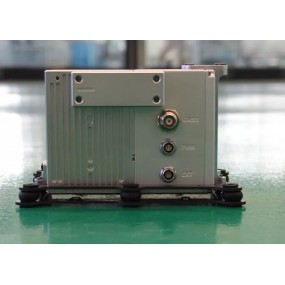
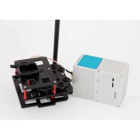
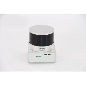
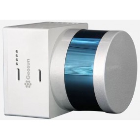
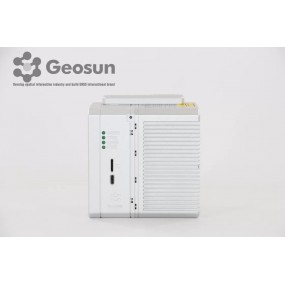
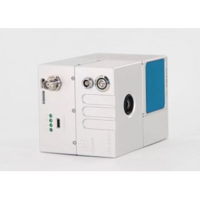
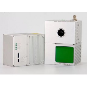
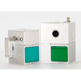
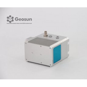
gAirHawk GS-100M+ LIDAR SCANNING SYSTEM
UAV LiDAR Scanning System with Triple Echo Livox Avia Laser Sensor
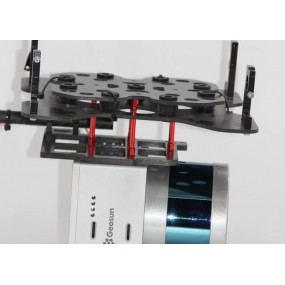
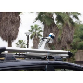
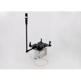
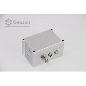
gAirHawk GS-100M+ is a kind of light compact LiDAR point cloud data acquisition system, integrated Livox new generation laser scanner, GNSS and IMU positioning and attitude determination system, and storage control unit, is able to real-time, dynamically, massively collect high-precision point cloud data and rich image information. It is widely used in the acquisition of 3D spatial information in surveying, electricity, forestry, agriculture, land planning.
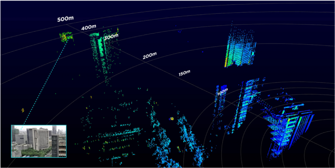
Long Detection Range
The Livox Avia adjusts its detection range according to the intensity of ambient light, while maintaining noise at a low level. The detection range increases to 450m under low-light conditions (such as on a cloudy day, indoors or at night), ensuring distant objects are captured in detail.
Dual-Scanning Mode
The use of multi-line laser and high-speed scanning enables the Livox Avia to achieve a point cloud data rate of up to 240,000 points/s. The high performance device is equipped with both repetitive and non-repetitive scanning modes, to meet the needs of different scenarios.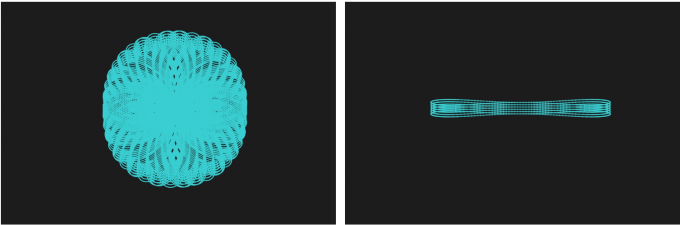
Specification
| gAirHawk GS-100M+ | ||
| Item Name | System Parameter | |
|
Parameter |
Weight | Less than 0.75 kg |
| Measuring accuracy | Less than 0.15 cm (100 m AGL) | |
| Power range | 12V~16V | |
| Working temperature | -20℃~+55℃ | |
| Consumption | Average 20W | |
| Carrier | GS-800 Multi Rotor, VTOL Fixed | |
| Storage | 64 GB storage, maximum support 128GB TF card | |
|
Lidar Unit
|
Laser Model | Livox Avia |
| Measuring Range | 190m@10% Reflectivity, 260m@20% Reflectivity, 450m@80% Reflectivity | |
| Laser class | 905nm Class1 (IEC 60825-1:2014) | |
| Laser line number | Equivalent to 64-beam | |
| Mix. range | 0.3 M | |
| Range Precision | 2 cm | |
| data | Triple echo, 720,000 Points/Sec | |
| FOV | 70° the circular view | |
| POS Unit | POS type | AGS 302 |
| Update frequency | 200HZ | |
| Heading accuracy | 0.04° | |
| Pitch accuracy | 0.015° | |
| Rolling accuracy | 0.015° | |
| Position accuracy | 0.02 - 0.05m | |
| GNSS signal type | GPSL1/L2/L5 GLONASSL1/L2 BDS B1/B2/B3 GAL E1/E5a/5b | |
| Pre-processing software | POS software | Output information: position, speed, attitude |
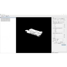
| Point cloud software | Output point cloud data format: LAS format, custom TXT format | |
| Camera (Option) | Camera Model | Sony a 6000 (Non standard) |
| Effective Pixel | 24 Mega Pixel | |
| Trigger event | Distance or Time trigger | |
| Weight (g) | Less than 300 |
|
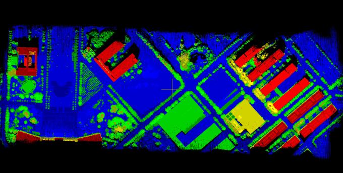
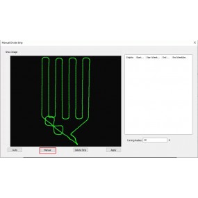
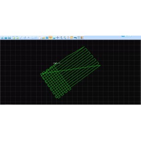
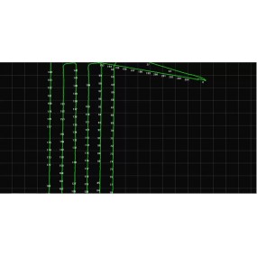
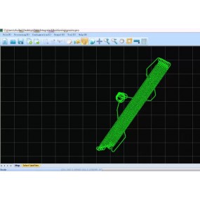
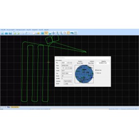
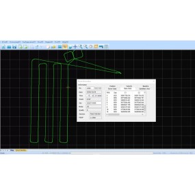
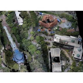
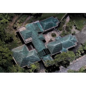
Application for Terrain
Package
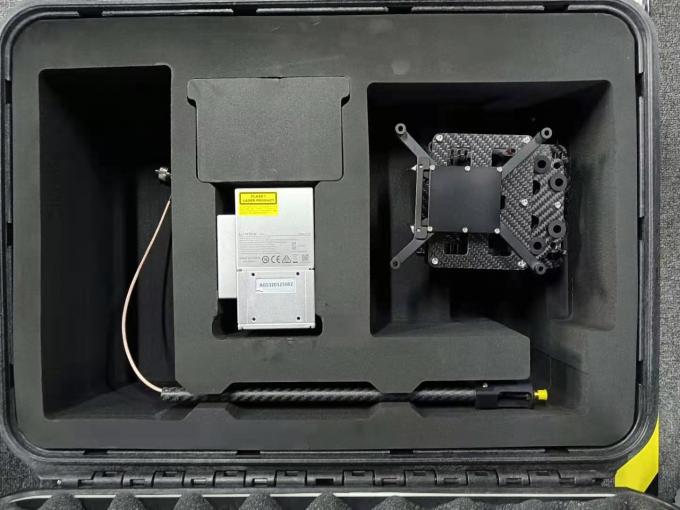
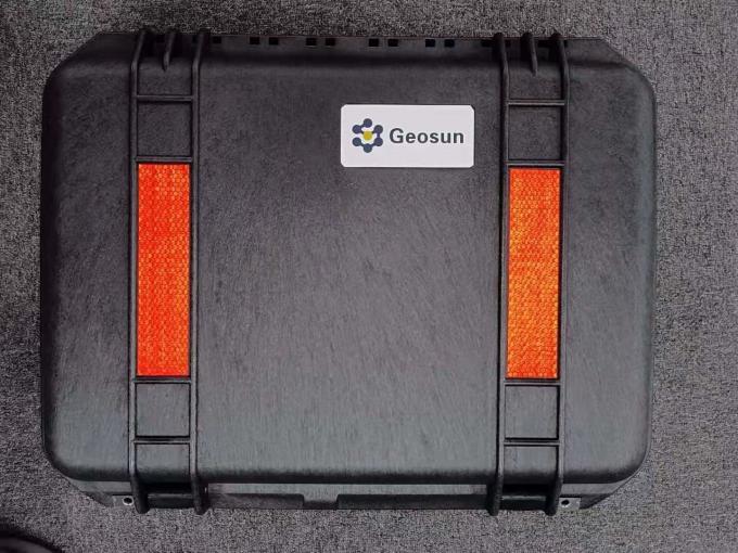
It is packed by suit case with EVA material liner inside, then covered by hard carton box. It is suitable for air shipment and sea shipment.
16 other products in the same category:
gAirHawk GS-260P LIDAR SCANNING SYSTEM Drone LiDAR Scanning System mounted on DJI M300 with 3D data collectiongAirHawk GS-260P is a kind of light compact LiDAR point cloud data acquisition system,...
gAirHawk Software Introduction Point Cloud Data Process and LAS File Generated SoftwaregAirHawk is a lidar scanning system acquisition monitoring and point cloud computing software self-developed...
GGPoS is a high accuracy GPS/GLONASS/BDS/Galileo positioning and velocity determination software system, which can process measured data of single-frequency /double-frequency...
Shuttle Software with Independent Property Right Shuttle Software with Trajectory Process , GNSS/INS Software Shuttle is a high-precision GNSS/INS positioning and attitude determination...
gAirHawk GS-260X UAV LIDAR SCANNING SYSTEM LiDAR Scanning System Application for 3D Surveying and Mapping gAirHawk GS-260X is a kind of Mid-range, compact LiDAR point cloud data acquisition system,...
GNSS/INS System Integrated Laser Sensors AGS 301 (302/303) adds a high-precision inertial navigation (IMU) module, no matter how the fuselage tilts during the aviation flight, it can accurately...
gAirHawk GS-100V LIDAR SCANNING SYSTEM Mobile LiDAR Scanning System with Velodyne Scanner gAirHawk GS-100V is a kind of short range, compact LiDAR point cloud data acquisition system, integrated...
GGPoS is a high accuracy GPS/GLONASS/BDS/Galileo positioning and velocity determination software system, which can process measured data of single-frequency /double-frequency...

gAirHawk GS-130H UAV LIDAR SCANNING SYSTEM UAV LiDAR Scanning System with Livox Horizon Laser Sensor gAirHawk GS-130H New Designed is a kind of short range, compact LiDAR point cloud data...

gAirHawk GS-260F UAV LIDAR SCANNING SYSTEM Drone LiDAR Scanning System Application for Mapping and Survey gAirHawk GS-260F is a kind of Mid-range, compact LiDAR point cloud data acquisition system,...
gAirHawk GS-100C+ LIDAR SCANNING SYSTEM Drone LiDAR Scanning System Mounted on DJI Drone with Livox Avia Laser Sensor and Build-in CameragAirHawk GS-100C+ is a kind of light compact LiDAR point...
gAirHawk GS-100C+ LIDAR SCANNING SYSTEM Mobile LiDAR Scanning System Mounted on Vehicle Integrated DJI L1 Laser Sensor and Build-in CameragAirHawk GS-100C+ is a kind of light compact LiDAR point...
gAirHawk GS-1350 UAV LIDAR SCANNING SYSTEM UAV LiDAR Scanning System with Long Range Riegl Sensor gAirHawk GS-1350 is a kind of long range, compact LiDAR point cloud data acquisition system,...
GNSS/INS System Integrated Laser Sensors AGS 302 (301/303) adds a high-precision inertial navigation (IMU) module, no matter how the fuselage tilts during the aviation flight, it can accurately...
gAirHawk Introduction 3D LiDAR Data Processing Software With Color PT File OutputgAirHawk is a lidar scanning system acquisition monitoring and point cloud computing software self-developed by...
| Operation Efficiency: | 1.92 Km2 / Single Flight | Applicaton: | Mapping & Survey |
|---|---|---|---|
| High Dencity: | 240000 Points/s | Light Weight: | Less Than 750 G |
| Compatibility: | Multi Rotor/ VTOL | Application: | Forestry |
| High Light: |
1.92km2 UAV LiDAR System20W UAV LiDAR System20W Triple Echo UAV LiDAR System |
||

error Your review appreciation cannot be sent