


| Name: | LAS File Output Software | Function 1: | Lidar Data Process |
|---|---|---|---|
| Function 2: | Point Clouds Data Output | Function 3: | Color Point Clouds Output |
| High Light: |
gAirhawk LiDAR Data Processing SoftwareLAS File Output LiDAR Processing Softwarereal time Data Processing Software |
||
gAirHawk Introduction
3D LiDAR Data Processing Software With Color PT File Output
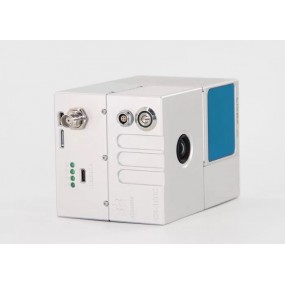
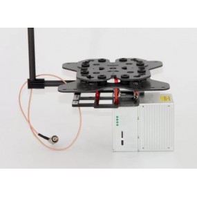
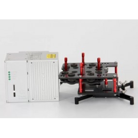
gAirHawk is a lidar scanning system acquisition monitoring and point cloud computing software self-developed by Geosun Navigation. It supports real-time configuration and monitoring of field data acquisition systems, decoding of real-time and post-process laser scanning data, calculation and display of point cloud data, supporting software for Geosun lidar scanning system.
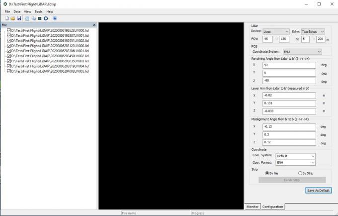
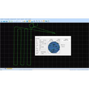
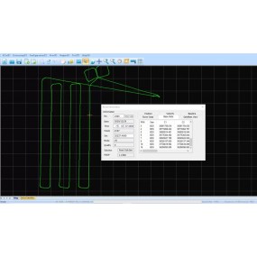
The Interface of gAirhawk
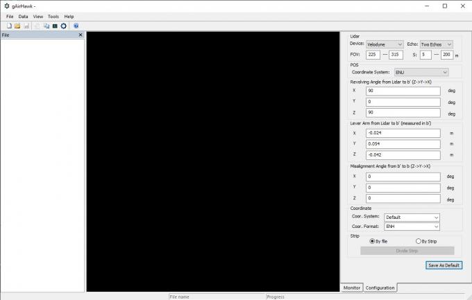
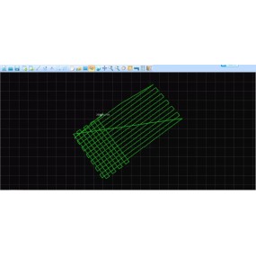
Creat New Project and Operation
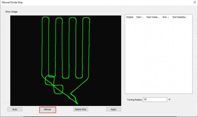
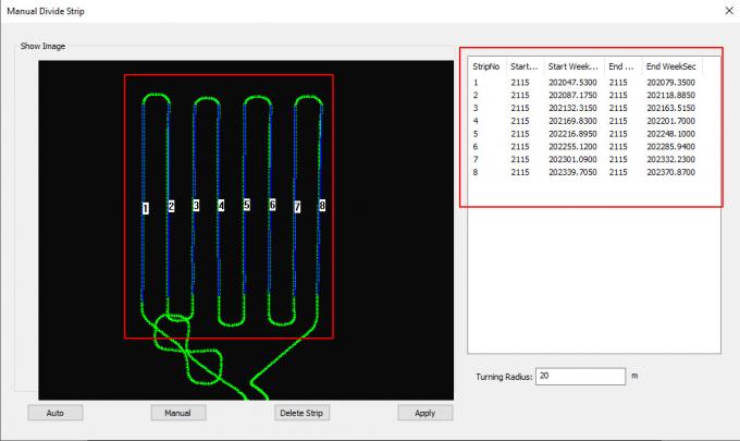
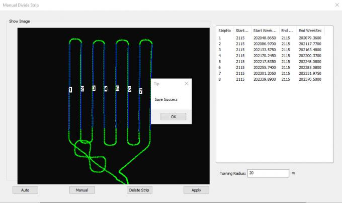
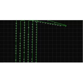
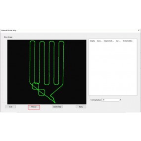
Divided by Strip
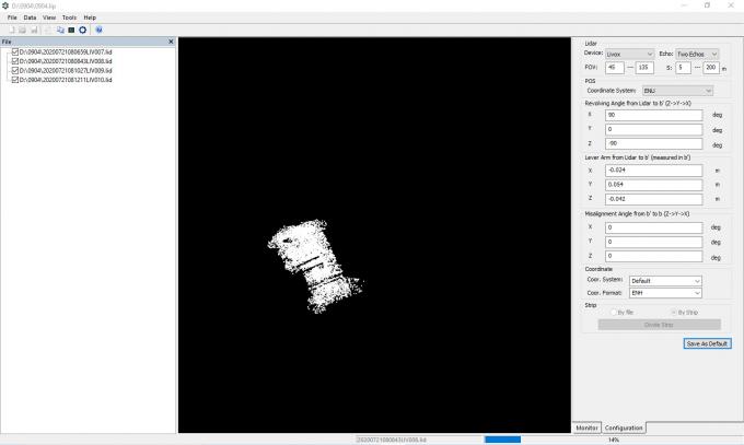
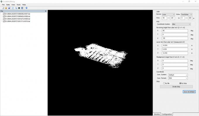
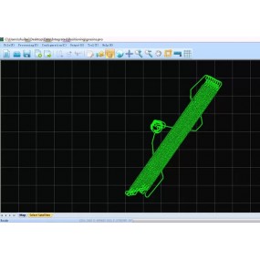
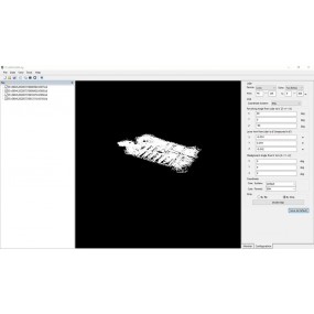
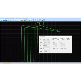
Lidar data process and point clouds output
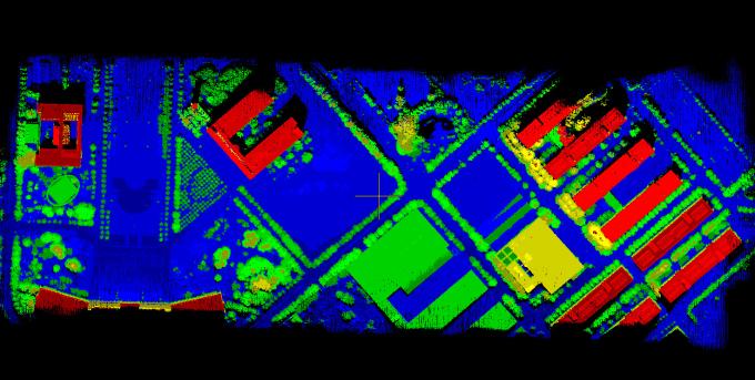
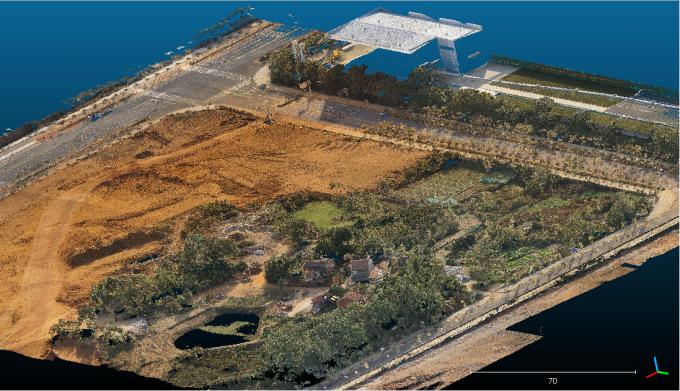
Color point clouds
The links of 4.6 version of gAirhawk software as following
https://drive.google.com/drive/folders/14PqJiu5K7_wKgyA6y4AZBZbdVBYZNd6O?usp=sharing
16 other products in the same category:
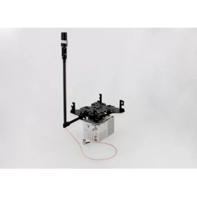
gAirHawk GS-260F UAV LIDAR SCANNING SYSTEM LiDAR Scanning System with HESAI Pandar Laser Sensor Mounted on DJI M600 Pro gAirHawk GS-260F is a kind of Mid-range, compact LiDAR point cloud data...
Shuttle Software with Independent Property Right Shuttle Software with Trajectory Process , GNSS/INS Software Shuttle is a high-precision GNSS/INS positioning and attitude determination...
gAirHawk GS-100V LIDAR SCANNING SYSTEM Mobile LiDAR Scanning System with Velodyne Scanner gAirHawk GS-100V is a kind of short range, compact LiDAR point cloud data acquisition system, integrated...
GNSS/INS System Integrated Laser Sensors AGS 302 (301/303) adds a high-precision inertial navigation (IMU) module, no matter how the fuselage tilts during the aviation flight, it can accurately...
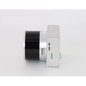
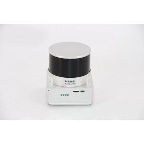
gAirHawk GS-260X UAV LIDAR SCANNING SYSTEM LiDAR Scanning System Application for 3D Surveying and Mapping gAirHawk GS-260X is a kind of Mid-range, compact LiDAR point cloud data acquisition system,...
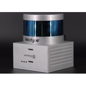
gAirHawk GS-100V UAV LIDAR SCANNING SYSTEM Uav LiDAR Scanning System with 3D Spatial Data Collecting Velodnye Laser Sensor gAirHawk GS-100V is a kind of short range, compact LiDAR point cloud data...
GGPoS is a high accuracy GPS/GLONASS/BDS/Galileo positioning and velocity determination software system, which can process measured data of single-frequency /double-frequency...
GNSS/INS System with 3D Data Collector AGS 300 adds a high-precision inertial navigation (IMU) module, no matter how the fuselage tilts during the aviation flight, it can accurately provide...
gAirHawk GS-100C+ LIDAR SCANNING SYSTEM Drone LiDAR Scanning System Mounted on DJI Drone with Livox Avia Laser Sensor and Build-in CameragAirHawk GS-100C+ is a kind of light compact LiDAR point...
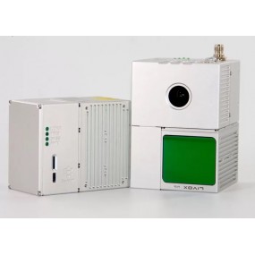
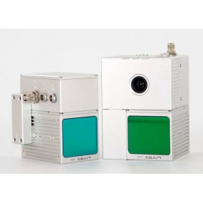
gAirHawk GS-100C+ LIDAR SCANNING SYSTEM Mobile LiDAR Scanning System Mounted on Vehicle Integrated DJI L1 Laser Sensor and Build-in CameragAirHawk GS-100C+ is a kind of light compact LiDAR point...
gAirHawk GS-100M+ LIDAR SCANNING SYSTEM UAV LiDAR Scanning System with Triple Echo Livox Avia Laser SensorgAirHawk GS-100M+ is a kind of light compact LiDAR point cloud data acquisition system,...
GNSS/INS System Integrated Laser Sensors AGS 301 (302/303) adds a high-precision inertial navigation (IMU) module, no matter how the fuselage tilts during the aviation flight, it can accurately...
gAirHawk Software Introduction Point Cloud Data Process and LAS File Generated SoftwaregAirHawk is a lidar scanning system acquisition monitoring and point cloud computing software self-developed...

gAirHawk GS-260F UAV LIDAR SCANNING SYSTEM Drone LiDAR Scanning System Application for Mapping and Survey gAirHawk GS-260F is a kind of Mid-range, compact LiDAR point cloud data acquisition system,...
GGPoS is a high accuracy GPS/GLONASS/BDS/Galileo positioning and velocity determination software system, which can process measured data of single-frequency /double-frequency...
| Name: | LAS File Output Software | Function 1: | Lidar Data Process |
|---|---|---|---|
| Function 2: | Point Clouds Data Output | Function 3: | Color Point Clouds Output |
| High Light: |
gAirhawk LiDAR Data Processing SoftwareLAS File Output LiDAR Processing Softwarereal time Data Processing Software |
||

error Your review appreciation cannot be sent